DRISHTI · NOTE 002.4
How Satellites Actually See
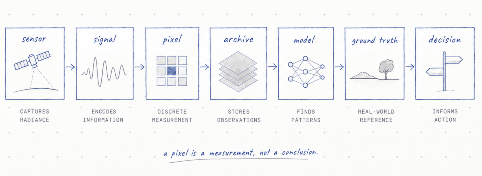
A satellite measures energy. Forests, floods, crop stress and damage are interpretations built on top.
EARTHVISION LAB · ~20 MIN READ
AN ACCIDENTAL PRECEDENT
Landsat 1 launched with two instruments. The Return Beam Vidicon was the one everyone expected to matter: an analog television camera, built on 1960s weather-satellite technology, considered the primary sensor. A defective power-switching circuit shut it down days after launch. The Multispectral Scanner System, an experimental secondary instrument nobody had fully trusted yet, took over as the mission's only working camera, and in doing so, decided what Earth observation would look like for the next fifty years: digital, not analog.
MULTISPECTRAL
A pixel is really several separate measurements
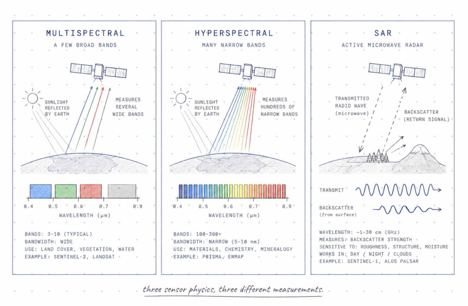
A satellite does not look down and see a forest, a farm, a flood or a city. It measures energy arriving at an instrument. The Multispectral Scanner recorded four bands at once, each a separate measurement of how much light bounced back at a specific wavelength. Healthy vegetation reflects strongly in near-infrared light and absorbs red, because chlorophyll absorption and leaf structure behave differently at those wavelengths. Water does close to the opposite, absorbing infrared and reflecting blue.
A single-band photograph cannot separate these materials reliably. A four-band scan, measured pixel by pixel, can. Modern instruments extended that insight rather than replacing it: Sentinel-2's imager carries 13 bands from about 443 to 2,190 nanometers, split unevenly across 10, 20, and 60-meter resolutions because different bands serve different purposes, and a band used only for atmospheric correction does not need the same detector geometry as one used to map a field.
The familiar indices come after the measurement, not instead of it. NDVI is not something a satellite senses directly. It is a ratio built from red and near-infrared reflectance after the fact, which means the compression can hide confounders such as soil background, canopy saturation, crop stage, atmosphere or viewing angle. NDVI can be useful without being plant health itself.
HYPERSPECTRAL
More bands, narrower bands, a different question entirely
Sentinel-2's 13 bands are wide enough to separate vegetation from water from bare soil, but too wide to say much about which specific mineral, pigment, or contaminant produced a given reflectance value. Hyperspectral instruments, also called imaging spectrometers, close that gap by measuring hundreds of narrow, contiguous bands instead of a dozen broad ones.
Germany's EnMAP satellite, launched in 2022, measures 224 usable bands across visible and infrared wavelengths at 30-meter resolution. Italy's PRISMA measures around 240. Where Sentinel-2's shortwave-infrared band tells you roughly how much water or clay is present, a comparable hyperspectral band can start to distinguish which clay mineral, because the full, nearly continuous reflectance curve carries information a handful of samples along it cannot.
The cost is data volume and processing complexity, which is why hyperspectral missions remain far less numerous than multispectral ones. Multispectral answers what kind of surface is this, broadly. Hyperspectral asks what exactly is this made of, at the price of an enormously larger dataset for the same patch of ground.
ACTIVE SENSING
One instrument sees regardless of weather or daylight
Every instrument described so far measures reflected sunlight, which means every one of them is blind at night and degraded under cloud. Synthetic Aperture Radar, SAR, solves both problems by not waiting for sunlight at all. It transmits its own radio signal toward the ground and measures what bounces back, using the satellite's own motion to synthesize an antenna far larger than the physical one it carries.
Sentinel-1 carries a C-band radar with four observation modes, trading resolution for coverage depending on the task: its finest mode resolves to about 5 meters, its widest covers a swath up to 400 kilometers. Because radio waves at this wavelength pass largely undisturbed through cloud, Sentinel-1 keeps collecting through storms that make optical imagery useless for days.
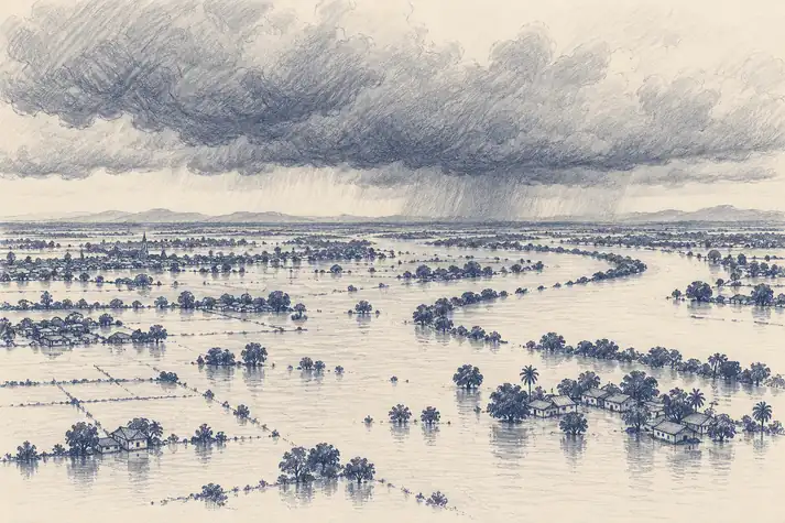
This is the closest Earth observation comes to a genuinely unmatched capability. Ground teams cannot map flood extent across a cloud-covered region overnight. Optical satellites cannot either. Radar can, which is why it became disaster response's default tool rather than a fair-weather curiosity.
FROM SIGNAL TO PICTURE
The rendered image is not the measurement
Multispectral reflectance, hyperspectral reflectance, and radar backscatter all get displayed as pictures on a screen, and that similarity can mislead. A radar measurement depends on surface roughness, moisture, and the angle it was viewed from. An optical measurement depends on illumination, atmosphere, and surface chemistry. The colors two instruments both render as a green patch can describe completely different physical states.
A camera in orbit may also record wavelengths human eyes cannot see, so software assigns those measurements to visible colours. A healthy plant may appear bright red because near-infrared reflectance has been mapped into the visible range. Nothing fake has happened. The measurement is real. The colour is a translation.
A familiar satellite image is therefore already the end of a chain of calibration, atmospheric correction, resampling and rendering. The forest, the crop type and the flooded house are interpretations built from measurements rather than things the instrument directly saw.
ONE PIXEL, MANY WORLDS
Scale changes the answer
Landsat's swath is 185 kilometers wide at 30-meter resolution; a hyperspectral mission like EnMAP images a much narrower strip at similar resolution because it is recording so much more per pixel; a wide-swath instrument like MODIS trades detail for reach entirely, at 250-to-1,000-meter pixels across 2,330 kilometers. Each number is tuned to a different question, not a different quality grade. No single satellite is built to answer every question at once.
A pixel can also contain part of a road, a tree, a roof and bare soil at the same time. The sensor records one combined signal. A model may classify that pixel correctly as urban land at a broad scale and still be useless at the scale of one household. Resolution is therefore not just a number in metres. The right resolution depends on the decision.
Better resolution helps, but it also creates more data, more noise and more temptation to claim precision that the underlying measurement does not support.
LABELS AND GROUND TRUTH
Meaning enters through people
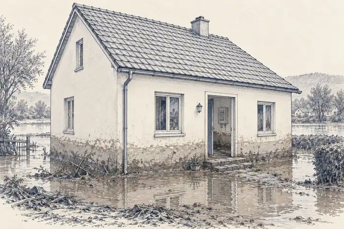
Suppose we train a model to find damaged buildings after a flood. Someone first has to define damage. Is a roof partly missing damaged? Is a house surrounded by water damaged? What about a building that looks intact from above but has lost its electrical system? The model learns from those labels, so a narrow definition produces a model that is excellent at a narrow idea of damage.
Ground truth is the usual reference, but even that phrase can sound more absolute than reality. A soil sensor measures one small place. A field survey happens at one time. A farmer may describe a crop differently from an insurance assessor. A weather station can be kilometres away from the parcel being studied. The ground is closer. It is not automatically complete.
This does not make satellite inference or AI unreliable by default. It means the definition of truth enters the system through measurements, scale, labels and reference data, each with limits of its own.
THE ANSWER
So what does a satellite actually know?
It knows what its instrument measured, within the limits of calibration, geometry, atmosphere and noise. Everything after that is inference.
That is not a weakness. Inference is how science works. We cannot drill into every glacier, measure every leaf or stand beside every river every hour. We build instruments, proxies and models because the planet is too large to inspect directly.
The useful discipline is to keep the measurement and the interpretation separate: ask what was actually observed, what was inferred, and what evidence would prove the inference wrong. A satellite can tell us an extraordinary amount about Earth. It becomes more trustworthy when we are precise about what it never saw.