DRISHTI · NOTE 002.2
The First Picture of Earth Fell Out of the Sky
A camera on a captured rocket, a spy program caught by a hook, and a geologist who wanted everyone to see.
EARTHVISION LAB · ~6 MIN READ
LOOKING DOWN
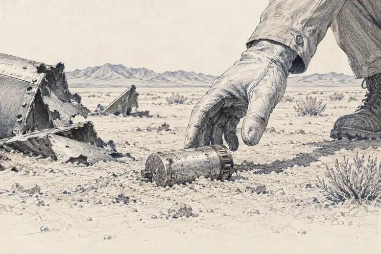
On 24 October 1946, a 35mm camera bolted to a captured German V-2 rocket rose from White Sands, New Mexico, climbed to roughly 105 kilometres and took the first photographs showing the curve of the Earth. Four minutes later the rocket arrived back in the desert at a speed that concluded its career. The film survived in a steel cassette built specifically to outlive the landing, which says something about how the engineers felt about the landing.
The pictures were grainy, black and white and taken almost by accident, and they did something no barometer or ringed starling could do. They showed the ground between the dots. A single frame held deserts, cloud systems and the edge of the planet at once, the whole scene that three centuries of instruments had been reconstructing one point at a time.
THE COVER STORY
A spy satellite that could not help photographing farms
Fourteen years later, the United States had a satellite doing the same thing on purpose. It was called Corona, though its public name was Discoverer, officially a scientific research program. In reality it photographed Soviet missile sites, airfields and submarine yards from orbit, and the cover story bought it years of uninterrupted work.
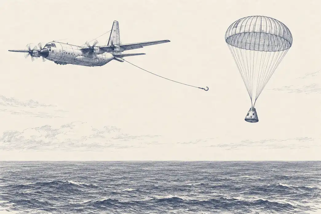
Corona could not transmit pictures, so the film came home physically. Engineers at General Electric built a reentry capsule nicknamed the film bucket, shielded against the heat of reentry, which released a parachute over the Pacific. An Air Force aircraft trailing a hook then caught the capsule in midair before it reached the water. This was not a figure of speech. It was the plan. The first twelve attempts failed in a satisfying variety of ways, until in August 1960 an aircraft snagged the capsule from Discoverer 14, carrying about 20 pounds of film, and a national intelligence program settled into running on the reliability of a hook.
What the film showed went well beyond its targets. A camera in orbit cannot choose to photograph only missile silos. Whatever passes beneath it gets recorded: wheat fields, river deltas, glaciers, forests, cities. When an executive order declassified Corona in 1995, more than 860,000 images from 1960 to 1972 became public, and scientists who had never cared about missiles found themselves comparing 1960s ice margins and river channels with the present. The satellite had been watching the planet all along. It simply had not been allowed to say so.
THE WHOLE VIEW
The weather got its picture first, then the whole planet did
The first civilian picture from orbit was of clouds. On 1 April 1960, TIROS-1 sent back a grainy television image of cloud cover over the eastern United States and Canada, and President Eisenhower, looking at it that evening, remarked on how small the Earth looked with its curve showing. Meteorologists had spent a century assembling storms from barometer readings telegraphed in from coastal stations. Now they could simply look at one.
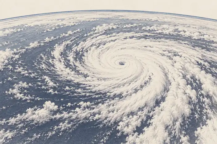
The difference showed within eighteen months. On 10 September 1961, TIROS III photographed a patch of disturbed weather a few hundred kilometres southwest of the Cape Verde Islands, far from any ship. Over the next two days ships and then a reconnaissance aircraft confirmed a circulation with hurricane-force winds, and it was named Esther: the first hurricane found by a satellite before anyone at sea had noticed it. FitzRoy had needed a coastline full of telegraph stations to see a storm coming. A single satellite now saw it forming in an empty ocean.
Then the view pulled back all the way. On 24 December 1968, on the fourth orbit of the Moon, Apollo 8's Bill Anders photographed Earth rising over the lunar horizon. On 7 December 1972, the crew of Apollo 17, about 29,000 kilometres out and with the Sun behind them, photographed the planet fully lit from Antarctica to the Mediterranean. Earthrise and the Blue Marble became two of the most reproduced images in history, and they did something no instrument before them had done: they showed the entire planet at once, to everyone. As measurements they were close to useless, being single frames taken from a spacecraft that was leaving. As a change in what people thought they lived on, they were hard to beat.
THE CIVILIAN CASE
A geologist argued for pointing the camera at everyone
A picture that changes how people feel is not the same as a picture that can be measured again next month. Years before Apollo, while Corona worked in secret, William Pecora, director of the U.S. Geological Survey, was making that second argument in public. If satellites could see resources, they should be watching them openly, for farmers, hydrologists and geologists, with the pictures published rather than locked away.
The course seems clear; we must make and execute bold plans to gather data on the Earth's resources, and to accelerate the search for natural resources.William Pecora, USGS Director, 1966
Pecora persuaded Interior Secretary Stewart Udall to announce the Earth Resources Observation Satellite program in a press release on 21 September 1966, before NASA had formally agreed to build it, which is one reliable way of getting a satellite built. NASA began work the following year on the Earth Resources Technology Satellite, ERTS-1, later renamed Landsat. Its optics were not so different from Corona's. The difference was who got to look.
Pecora died on 19 July 1972, four days before ERTS-1 launched from Vandenberg Air Force Base and became Landsat 1. It carried an experimental scanner that recorded the ground as numbers rather than on film, which meant its pictures could be sent down by radio instead of caught by aircraft. What it proved was not that Earth could be seen from orbit, since Corona had shown that in secret. It proved that an open, repeating picture of the planet was worth having in peacetime, and it set the terms for every civilian observing program since.
1946
V-2 camera · first curvature
1960
Corona capsule caught · secret
1966
Pecora's EROS proposal · public
1972
Landsat 1 launches
The same view, first hidden, then published.
THE RULES OF THE NEW VANTAGE POINT
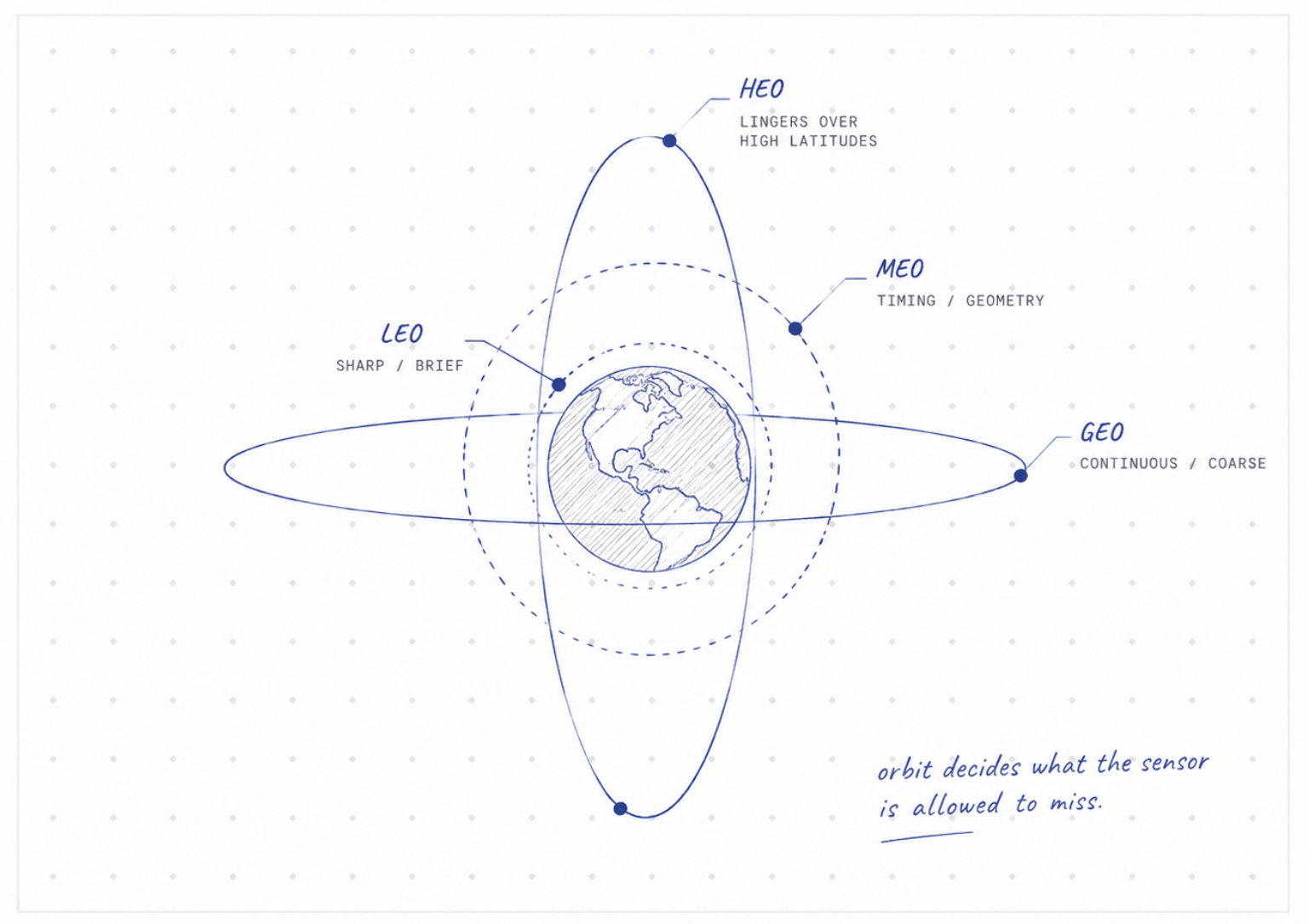
Where you stand in orbit decides what you see
Leaving the ground did not end the question of where to stand. It turned it into orbital mechanics. Landsat flies at 705 kilometres, low enough to see detail 30 metres across and close enough that it sees only a 185-kilometre strip at a time, returning to the same strip every 16 days. Its orbit is tilted about 98 degrees, a choice that exploits the fact that Earth is slightly fat around the middle: the equatorial bulge slowly swings the orbit around at exactly the rate Earth circles the Sun, so the satellite crosses every place at the same local time on every pass for its whole life. The Sun sits at roughly the same angle in an image from 1985 and one from 2025, courtesy of the planet's waistline.
Weather wanted the opposite. At 35,786 kilometres above the equator, a satellite circles exactly as fast as Earth turns, so it hangs over one spot and watches continuously. NOAA's GOES satellites use that geometry to watch storms form minute by minute, trading detail for constancy: a pixel there covers about a kilometre rather than 30 metres. The poles, which a satellite over the equator sees only at a steep slant, got their own answer from Soviet Molniya satellites, which follow a long ellipse that dawdles for hours over high latitudes, because a satellite moves slowest when it is farthest away.
Each orbit sees something the others cannot, and none sees everything. So missions began stacking them. NASA flew two satellites, Terra and Aqua, crossing the equator three hours apart so the same instrument could look twice a day. Europe put two Sentinel-2 satellites in one orbit on opposite sides of the planet, halving the wait between looks from 10 days to 5. The ground era had spent three centuries adding stations. The orbital era began adding satellites, and it had barely started.