COSMICS · CHAPTER 6.3
A Forest Has an Inside
Canopy cover is easy to see. The vertical structure, understory and hidden geometry beneath it are much harder.
EARTHVISION LAB · ~15 MIN READ
OCCLUSION
A conventional satellite image of a forest is dominated by the top of the canopy because that is the part intercepting and reflecting most of the incoming light. This is useful for mapping extent, disturbance and canopy condition. It is also a peculiar way to describe a structure that may extend from leaf litter to crowns tens of metres above the ground.
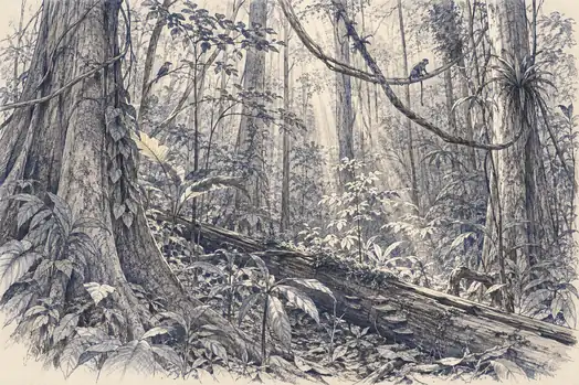
Inside that vertical space are trunks, branches, lianas, dead wood, gaps, understory plants, epiphytes, animals, humidity gradients and light environments that can differ sharply from the canopy surface. Two forests can present similar greenness from above while containing different biomass, age structure and habitat complexity underneath.
The difficulty has a name from computer vision and physics: occlusion. One object blocks another from the sensor. Increasing pixel resolution does not solve it if the upper leaves still occupy the line of sight. A sharper photograph of a roof remains a photograph of a roof.
FULL-WAVEFORM LIDAR
GEDI turned a laser echo into a vertical profile
NASA's Global Ecosystem Dynamics Investigation, GEDI, approaches the problem by measuring the return of a laser pulse through time. Light reflected from the canopy top returns first. Energy from lower branches and vegetation returns later. Where enough light reaches the ground, the ground return arrives later still. The waveform therefore contains a vertical distribution rather than one surface brightness value.
GEDI's footprints average about 25 metres across. Its beams produce tracks with observations about 60 metres apart along-track and roughly 600 metres between neighbouring tracks. The instrument does not photograph every square metre of forest. It samples vertical structure along a very large set of transects, which can then be combined with other data and models to estimate broader patterns.
From those waveforms, GEDI products derive canopy height, canopy cover, plant-area profiles, foliage-height diversity and above-ground biomass density. The important distinction is that the sole direct observable is the waveform. Biomass is estimated from relationships calibrated against airborne lidar and field inventory plots.
This is a stronger view of a forest's inside than ordinary imagery provides, but it remains a sampled structural view. A waveform can reveal where vegetation material is distributed vertically. It does not identify every species occupying each layer or describe the ecological interaction occurring there.
ESA BIOMASS
P-band radar made woody structure visible through the canopy
ESA's Biomass mission, launched on 29 April 2025, attacks a related blind spot with a much longer radar wavelength. Its P-band synthetic aperture radar uses a wavelength of roughly 70 centimetres, allowing more of the signal to penetrate through foliage and interact with larger woody components such as trunks and branches.
The mission is designed to produce repeated global estimates of forest biomass and height, quantities that matter because most forest carbon is stored in woody material rather than the leaves most visible from above. ESA explicitly describes the mission as a way to reduce major uncertainties in carbon stocks and fluxes associated with degradation, loss and regrowth.
Penetration is not transparency. The returned radar signal is still a mixture of interactions with vegetation and ground whose interpretation depends on structure, moisture, geometry and calibration. Biomass is inferred from those returns rather than counted branch by branch. The forest has permitted us a better echo, not an inventory.
The mission is also a reminder that sensing depth is relative. A wavelength capable of reaching through a forest canopy may also reveal subsurface geology in dry deserts, while still being unable to resolve the fine ecological details of a tropical understory. A signal can penetrate further without answering every question waiting underneath.
THE UNDERSTORY
Structure is not the same as the life occupying it
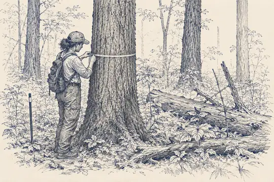
Forest ecology often cares about variables that neither canopy imagery nor structural lidar directly identifies: seedling recruitment, understory composition, invasive plants, dead wood, fungal fruiting, animal use of microhabitats and the small gaps that control regeneration. These are spatially patchy and often hidden beneath several layers of vegetation.
Field plots remain important because they name what the remote signal cannot. GEDI's own biomass calibration depends on globally assembled ground inventories paired with airborne lidar. The ground plot is not an embarrassing leftover from the era before satellites. It is part of the measurement chain that teaches a remote waveform what biomass means.
Airborne and terrestrial lidar can provide denser three-dimensional detail over smaller areas. Drones can fly below or closer to canopies. Camera traps and acoustic recorders sample animals. Environmental DNA can reveal organisms from traces. Each method opens another interior and exposes another one behind it.
This is why a forest is a useful test for claims of complete observation. We can map its boundary, estimate its height and biomass, monitor its disturbance and still know little about who occupies a particular shaded square metre beneath the crowns. The object called forest changes depending on which layer of it matters.
WHAT COUNTS AS SEEN
Visibility is a property of the question
A forest may be well observed for deforestation and poorly observed for understory biodiversity at the same moment. There is no single coverage score that settles both questions. The sensor, spatial scale and variable define what counts as visible.
This matters for planetary intelligence because data layers often inherit broad names. Forest cover. Biomass. Habitat. Each name can make a partial measurement sound like the object itself. The layer is useful precisely because it compresses reality into one property. Trouble begins when the compression is forgotten.
The inside of a forest is not a residual detail waiting for a better satellite. Some of it will be measured from space, some from aircraft, some from instruments on the ground and some through biological sampling. Observability is an architecture assembled around a question, not a camera with unlimited patience.
A forest can be completely green on a map and still contain an enormous amount of darkness underneath.