COSMICS · NOTE 002.6
Landsat and the Invention of Planetary Memory
The archive that measures the Aral Sea's collapse nearly broke three separate times.
EARTHVISION LAB · ~15 MIN READ
THE LONGEST RECORD
Landsat 1 launched on 23 July 1972. Landsat 9 is still flying. Every satellite in between has asked the same question of the same ground, every 16 days, for over fifty years: what does this look like now compared to last time. No other Earth observation program has kept asking that question for as long, and the record only has value because nobody let it stop.
WHY REPETITION MATTERED
A single photograph cannot prove that anything changed
William Pecora's argument for Landsat was about resources, not repetition for its own sake. But a resource inventory taken once tells you what exists today and nothing about the rate at which it is disappearing or growing. To measure change, you need at least two measurements, taken the same way, far enough apart to matter.
Landsat's contribution was never a single sharp photograph. Reconnaissance satellites like Corona had already produced those, in secret, a decade earlier. Landsat's contribution was doing the same thing in public, on a fixed schedule, without stopping, so that the second measurement always eventually arrived.
That distinction is easy to state and hard to fund. A single satellite is a project with a launch date and a budget line. An unbroken fifty-year record is a commitment that outlives the people who approved it, which is precisely the kind of commitment that gets cut first when budgets tighten.
THE PRICE COLLAPSE
The archive existed for two decades before anyone could afford it
For its first years, Landsat imagery was expensive enough that only funded research projects used it. The USGS cut the price to $600 a scene in 1991, still enough to keep casual use rare: about 53 scenes left the archive per day.
On 21 April 2008, the USGS made every scene free. Daily downloads jumped to 5,775, more than a hundred times the paid rate, almost overnight. By 2017, annual downloads stood at 20 times their 2009 level, and Landsat-based scientific publications had roughly quadrupled.
The imagery itself had not changed. What changed was who could justify spending time on a question that might not pan out. At $600 a scene, only a funded hypothesis could afford to be wrong. At no cost, a graduate student could try something speculative on a Tuesday afternoon. The volume of science the archive produced was gated by price for far longer than it was gated by the satellite's capability.

CROSS-CALIBRATION
Nine satellites had to agree on what a number means
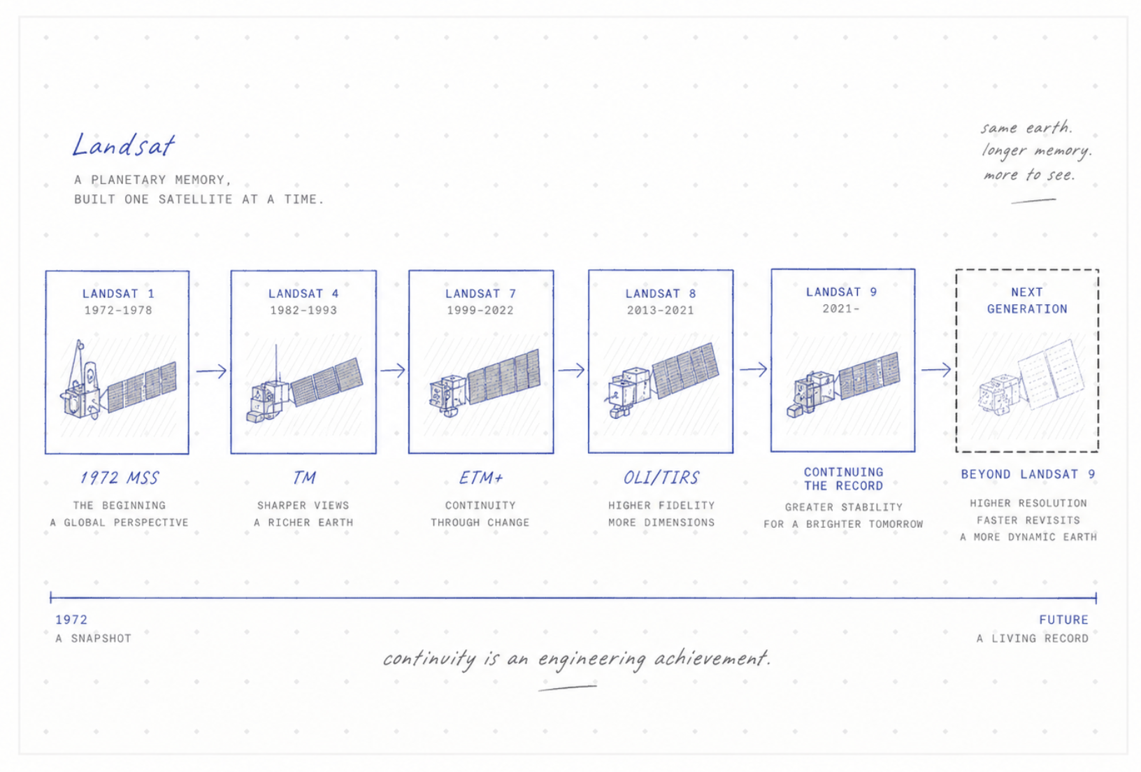
Landsat 1's Multispectral Scanner measured four bands at roughly 80 meters. Landsat 4 and 5 carried the Thematic Mapper, sharper and covering more of the spectrum. Landsat 7 added the Enhanced Thematic Mapper Plus, with a 15-meter panchromatic band layered on top of the same 30-meter multispectral bands. Landsat 8 and 9 carry the Operational Land Imager and Thermal Infrared Sensor, built on pushbroom detector arrays rather than the earlier scanning mirror. These instruments do not produce numbers that mean the same thing by default. The World Reference System, the fixed grid of path-and-row identifiers every Landsat scene is filed under, only tells you which ground was measured, not whether two measurements of it can be compared directly.
If an NDVI value of 0.5 measured by the Thematic Mapper in 1990 does not mean the same thing as an NDVI value of 0.5 measured by the Operational Land Imager in 2020, the fifty-year record is not one record. It is nine incompatible ones stitched together by hope.
Calibration scientists solved this the unglamorous way: flying successive satellites over the same ground on overlapping days, comparing their raw output, and publishing correction factors so that later instruments' numbers could be translated back into consistency with earlier ones. That work, largely invisible to anyone using the data, is the actual reason a scientist today can plot a single trend line running from 1972 to the present without a discontinuity where one satellite handed off to the next.
HOW CLOSE IT CAME
The unbroken record almost broke three separate times
In 1985, Landsat's operation was handed to a private company under a commercialization law, and by 1989 the company and NOAA planned to shut down the two remaining satellites for lack of operating budget. Congress and the National Space Council intervened to keep them flying until a replacement launched.
On 5 October 1993, Landsat 6 failed to reach orbit at all, the only outright launch failure in the program's history, traced to a ruptured propulsion manifold. Had Landsat 4 and 5 not still been limping along from the previous crisis, that failure alone would have ended the record.
In May 2003, Landsat 7's Scan Line Corrector failed in orbit, and every image the satellite has taken since carries diagonal gaps of missing data. The satellite kept flying, its data usable but permanently degraded, until Landsat 9 finally replaced it in September 2021. Three separate failures, three separate decades, and the record survived each one by a narrower margin than the fifty-year total suggests.
1985
Privatized · handed to EOSAT
1989
Near-shutdown · Quayle intervenes
1993
Landsat 6 fails to orbit
2003
SLC fails · permanent striping
2021
Landsat 9 · record continues
The record survived each one by a narrower margin than fifty years suggests.
WHAT THE RECORD SHOWS
What only became visible once nobody let it stop
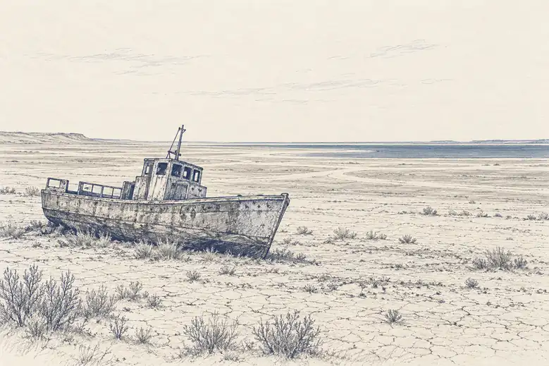
The Aral Sea covered roughly 68,000 square kilometers in 1960. Landsat's repeated passes through the following decades documented it shrinking to under a tenth of that size, not as a single dramatic before-and-after but as a continuous, measurable recession that no single photograph could have captured.
Brazilian deforestation shows the same pattern in reverse emphasis: Landsat-derived monitoring recorded annual forest loss accelerating through the 1990s, peaking at close to 28,000 square kilometers in a single year in the early 2000s, then declining as enforcement measures took hold, a trend visible only because the measurements kept being taken after the story seemed to already have an ending.
Landsat 9 is currently the newest satellite flying, but a successor is already funded: Landsat Next, planned for launch around late 2030 or 2031, will replace one large satellite with a constellation of three, each carrying 26 spectral bands, more than double the current generation. Whether that plan survives to launch depends on the same kind of decision that nearly ended the record in 1989: not a technical one, but a budgetary one, made by people who will not personally see most of what the next fifty years would show.